US census 2020 geography leaders meet with ASU students
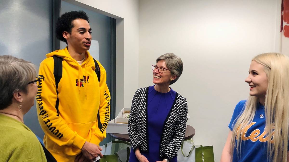
Deirdre Dalpiaz Bishop, chief of the geography division at the U.S. Census Bureau (center), speaks to students in the School of Geographical Sciences and Urban Planning.
Students in the School of Geographical Sciences and Urban Planning recently had the opportunity to meet one-on-one with the lead geographer of the U.S. census and others to learn about how geographic information systems (GIS) and maps play a key role in the decennial U.S. census process.
“We’re very proud of the design of the 2020 U.S. census, and I would like the students at ASU to know that we’ve incorporated the use of geography and geographic information systems throughout the design of the census,” said Deirdre Dalpiaz Bishop, chief of the geography division at the U.S. Census Bureau. “Whether it’s the building of our address list or motivating people to self-respond, even knocking on the doors if people don’t respond, we’re using GIS throughout the process.”
Bishop, accompanied by colleagues Trudy Suchan and Vicki McIntire, talked to small circles of students, faculty and staff about how GIS and technology have contributed to significant cost savings and increased operational efficiency in the U.S. census process. In addition, they answered questions on topics ranging from employment opportunities with the census to technological advancements the census is implementing in 2020 to how the census works and why it is important.
“I was 11 when the last census was going on, and I don’t really remember anything about it,” said Taylor Berkabile, a geography junior. “It’s interesting to get to talk to people who actually work with the census and get more information about it.
“Being here helps me see what my options are graduating with a geography degree. I’m interested in learning about her (Bishop’s) experiences working in that field, as an option of something I can do.”
Urban planning junior Nathan Warren, who is taking a class on population geography, said the census event caught his interest because it was an opportunity to learn about a process he wasn’t previously familiar with.
“I’m learning about urban planning, the census, how a lot of data is used in predictions, and I’m growing my understanding of the geography piece of it,” Warren said. “Now, putting all of these things together opens up a lot of critical thinking for me. It’s very interesting how it all connects together.”
The sky’s the limit
Bishop wants students to know that as technology evolves and the use of GIS and geography systems become more integrated into daily life, career opportunities will continue to grow.
“When I first started working, there weren’t many options. You could work for the federal government or you could work for the planning board that uses GIS, but today, the sky’s the limit,” Bishop said. “Don’t limit yourself; look at all opportunities — and I would first suggest pursuing informational interviews with experts in the industry to learn more about what they do, and then really to pursue as many different opportunities as possible to find the right fit.
“You can work for the government, you can work for a local organization, a nonprofit organization, a business — everyone is using GIS and everyone understands the power of the technology.”
When asked if she had anything else she wanted to tell students, Bishop said with a smile, “I would like everyone to self-respond to the census in March and April 2020.”
A simple reminder that every person counts.
More Environment and sustainability
Confusion complicates US recycling efforts
In most major cities and buildings, recycling bins can often be found alongside trash bins in an effort to encourage recycling.…

ASU empowers students to build a thriving global future
At Arizona State University, leadership has made tremendous efforts to create programs and initiatives aimed at supporting a…
Colorado River becomes an outdoor classroom for these middle school students
Griffin Freburg doesn’t usually look forward to science class. But on a sunny day in March, the eighth grader changed his tune.…