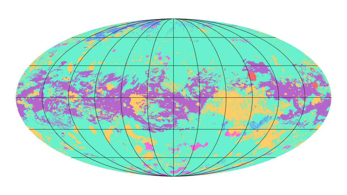
The first map showing the global geology of Saturn’s largest moon, Titan, has been completed and fully reveals a dynamic world of dunes, lakes, plains, craters and other terrains.
Planetary geologist David Williams of Arizona State University’s School of Earth and Space Exploration worked with a team of researchers, led by planetary geologist Rosaly Lopes of NASA’s Jet Propulsion Laboratory in Pasadena, California, to develop this global geologic map of Titan. The map, and their findings, which include the relative age of Titan's geological terrains, were recently published in the journal Nature Astronomy.
Titan is the only planetary body in our solar system other than Earth known to have stable liquid on its surface. But instead of water raining down from clouds and filling lakes and seas as on Earth, on Titan what rains down is methane and ethane — hydrocarbons that we think of as gases but that behave as liquids in Titan's frigid climate.
"Titan has an active methane-based hydrologic cycle that has shaped a complex geologic landscape, making its surface one of most geologically diverse in the solar system," said lead author Lopes.
"Despite the different materials, temperatures and gravity fields between Earth and Titan, many surface features are similar between the two worlds and can be interpreted as products of the same geologic processes. The map shows that the different geological terrains have a clear distribution with latitude, globally, and that some terrains cover far more area than others," Lopes said.
Lopes' team used data from NASA's Cassini mission, which operated between 2004 and 2017 and did more than 120 flybys of the Mercury-size moon Titan. Specifically, they used data from Cassini's radar imager to penetrate Titan's opaque atmosphere of nitrogen and methane. In addition, the team used data from Cassini's visible and infrared instruments, which were able to capture some of Titan's larger geologic features through the methane haze.
"This study is an example of using combined data sets and instruments," Lopes said. "Although we did not have global coverage with synthetic aperture radar (SAR), we used data from other instruments and other modes from radar to correlate characteristics of the different terrain units, so we could infer what the terrains are even in areas where we don’t have SAR coverage."
-
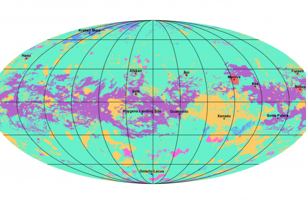
The first global geological map of Saturn's largest moon, Titan, is based on radar and visible and infrared images from NASA's Cassini mission, which orbited Saturn from 2004 to 2017. Labels point to several of the named surface features. Also located is the landing site of the European Space Agency's Huygens Probe, part of NASA's Cassini mission.
Image by NASA/JPL-CalTech/ASU
-
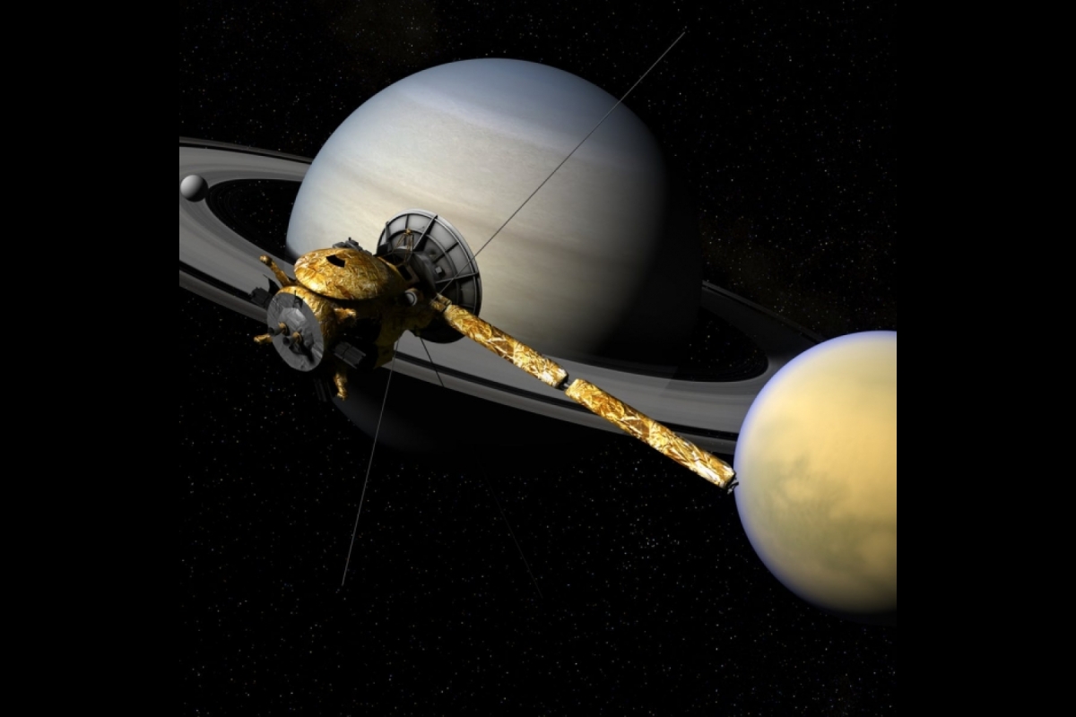
Artist rendition of the Cassini spacecraft with Saturn and Titan.
Image by NASA/JPL-CalTech
-
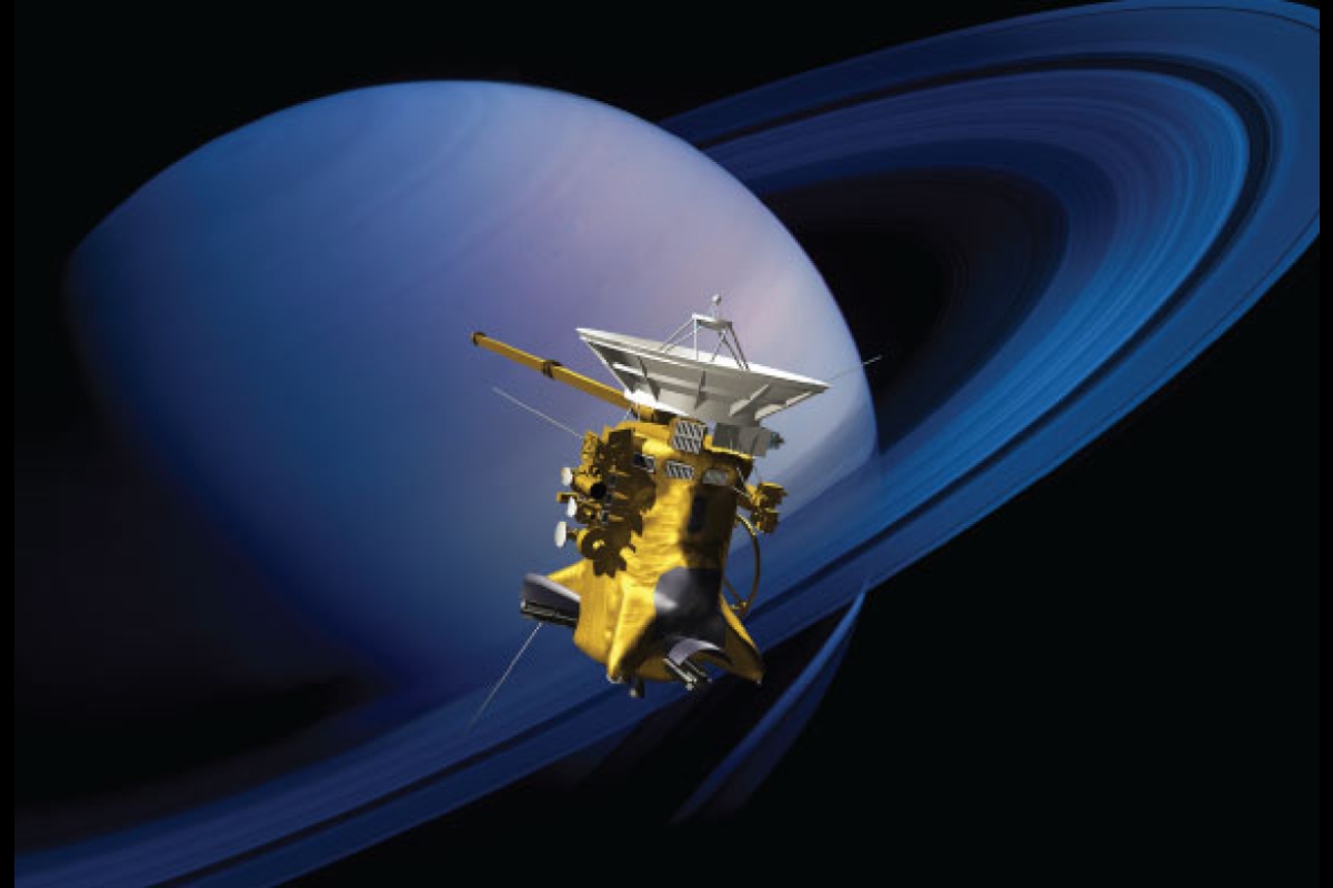
Artist rendition of the Cassini spacecraft with Saturn.
Image by NASA/JPL-CalTech
Williams' role in mapping Titan was to work with the JPL team to identify what geologic units could be determined using first the radar images and then to extrapolate those units to the non-radar-covered regions. To do so, Williams built on his experience working with radar images on NASA's Magellan Venus orbiter and from a previous regional geologic map of Titan that he developed.
"The Cassini mission revealed that Titan is a geologically active world, where hydrocarbons like methane and ethane take the role that water has on Earth," Williams said. "These hydrocarbons rain down on the surface, flow in streams and rivers, accumulate in lakes and seas, and evaporate into the atmosphere. It’s quite an astounding world!"
Williams, who is also the director of the Ronald Greeley Center for Planetary Studies at ASU, has considerable experience working on the geologic mapping of small and unusual planetary objects, including Jupiter’s volcanic moon Io, the asteroid Vesta, the dwarf planet Ceres and now Titan.
“We held meetings at ASU earlier this decade to figure out how to map Titan using the higher-resolution radar and lower-resolution visible images,” explained Williams. “Titan mappers from NASA’s Jet Propulsion Laboratory and Cornell University came to ASU to figure out how to do geologic mapping of this strange new world.”
The experience of mapping small and unusual planetary objects will help Williams on an important task he will undertake in the next decade, to make the first global geologic map of metal asteroid (16) Psyche, the target of the ASU-led NASA Psyche mission scheduled to launch in 2022.
The Cassini-Huygens mission is a cooperative project of NASA, the European Space Agency (ESA) and the Italian Space Agency. NASA's JPL, a division of Caltech in Pasadena, California, manages the mission for NASA's Science Mission Directorate, Washington. JPL designed, developed and assembled the Cassini orbiter. The radar instrument was built by JPL and the Italian Space Agency, working with team members from the U.S. and several European countries.
Get more information about Cassini.
Top image: The first map showing the global geology of Saturn's largest moon, Titan, is based on radar and visible and infrared images from NASA's Cassini mission, which orbited Saturn from 2004 to 2017 and Imaging Science Subsystem (ISS) images. Image by NASA/JPL-CalTech/ASU
More Science and technology

SpaceHACK highlights student solutions to environmental challenges, digital divide
By Adrianna Nine About 250 students from around the world convened online and at Arizona State University on March 22 for the ASU Interplanetary Initiative’s second annual SpaceHACK for…

New AI for a new era of discovery
As the legend goes, in 1665, Sir Isaac Newton sat in his garden at Woolsthorpe Manor in England and looked on as a lone apple dropped from a tree branch, falling straight down. This chance encounter…

ASU receives 3 awards for research critical to national security
Three researchers in the Ira A. Fulton Schools of Engineering at Arizona State University have received grant awards under the Defense Established Program to Stimulate Competitive Research, or…