ASU students partner with city to create a plan for quality growth
Students working on improving a trail system for walking, biking and horseback riding listen to perspectives of an Apache Junction resident. Photo by Pai Li
Apache Junction is a city of about 38,000 residents with a natural setting that rivals any in the state for scenic views and outdoor opportunities. Twenty-five years from now, its population is projected to be nearly double the current total.
“It’s not a question of whether the city will grow, it’s a question of how,” Giao Pham, the city’s public works director, said.
After a semester’s work by 21 Arizona State University graduate students, the city has a new outline to guide its development, grounded in residents’ perspectives and thorough research.
The students were enrolled in this spring’s capstone course for ASU’s master’s program in urban and environmental planning (MUEP), taught by professor Joochul Kim. The program is within the School of Geographical Sciences and Urban Planning.
The project, which began as a collaboration with the city’s Public Works and Development Services departments, grew to include the Parks & Recreation and Economic & Business Development departments, as well. Following an April 26 presentation to the city’s Planning & Zoning Commission and Parks & Recreation Board, Apache Junction’s City Council approved a resolution to adopt the students’ report for consideration for the city’s future planning purposes.
“We’re very appreciative of what the students did. The capstone is a great opportunity for students, but also a great opportunity for the community. The students’ work will really make a difference,” said Larry Kirch, city of Apache Junction development services director.
The project’s scope
The partnership began in summer 2015, when Bailey DuBois, a student in the urban and environmental planning master’s program, approached the city to ask whether it might consider being the site for the program’s capstone workshop course. Larry Kirch, the city's development services director, and Pham responded enthusiastically, and discussions began.
In January 2016, Kim introduced the students in his capstone course to their assignment: After learning about Apache Junction — from city representatives, planning documents, demographic and economic research, and importantly, by exploring the city in person — they would envision a future for Apache Junction.
The students were to develop an overall community vision for:
- The downtown area along Idaho Road and the Apache Trail
- The largely undeveloped state-owned area south of U.S. 60
- Trails to connect the city — usable by pedestrians, equestrians and bicycles
The students formed themselves into three teams, each focusing on one of the three challenges.
Dubois and classmate Melissa Spriegel volunteered for the role of facilitators: serving as the point of contact for city officials, collecting weekly reports from each team, scheduling presentations either within the class or with city officials and residents, and coordinating creation of a final report.
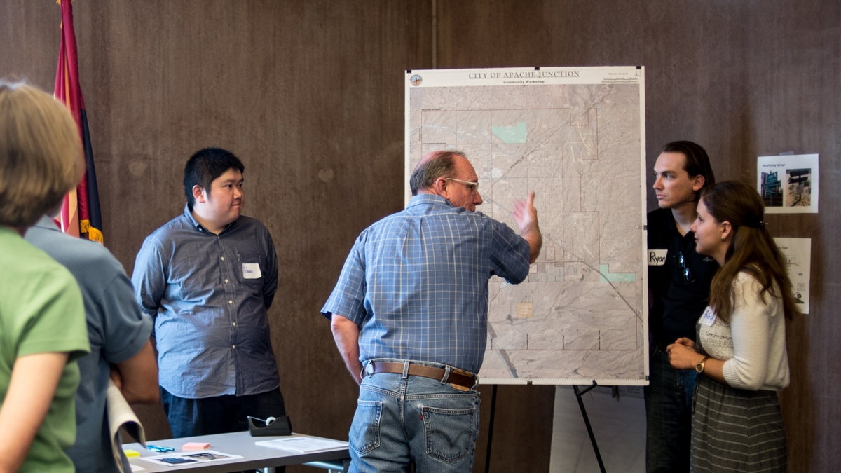
To be sure their ideas were in line with Apache Junction residents, the students organized two community meetings.
Creating a town center
“We want a town center,” the downtown group heard. At the first community meeting, the group worked to understand where residents currently identify the center of downtown to be, what the residents would like to see develop, and what qualities and amenities were essential to the city’s identity.
Participants at the first community meeting identified what location they perceived as the city’s downtown (red dots), the places they go regularly (pink arrows) and their ideas for amenities they’d like to see (blue arrows).
With information from the first meeting in hand, the students studied the city’s existing planning documents and successes in comparable towns. They developed proposals and sketches and presented them at a second community meeting — then revised the plans again to develop their final proposals.
“We wanted to be positive that we were representing the desires of the community,” said Morgan Klaas, leader of the first downtown visioning group.
From the city’s perspective, the students’ work is helping to maintain momentum for development. “The students’ work reinforced the city’s efforts to develop a sense of place for the downtown,” Kirch said.
This proposal represents two versions of a relatively simple-to-develop public event space that could help define Apache Junction’s downtown. Images by Carol Hu
Undeveloped state land: Economic development and natural preservation
The half-mile strip between U.S. 60 and Baseline Road currently hosts a golf course and smattering of mostly residential developments. South of Baseline, the city boundaries encompass about 12 square miles of primarily open desert, with only one existing north-south road.
The state land group needed to consider how to create economic opportunities for this area, while preserving the its natural wealth — especially its washes and views of the Superstition Mountains.
The students proposed a network of roads that would allow access to the area, but they adjusted the east-west grid to keep washes in their natural state as much as possible. Map by Bryan Smith
Led by Bryan Smith and Spencer Bolin, the group analyzed potential business opportunities for the area from U.S. 60 to Baseline Road, envisioning a strip south of Baseline as a walkable main street promoting local businesses.
The team also focused on a 4-square-mile area of undeveloped land, the “planned unit development” or PUD. Here, the students’ proposals respected an overwhelming opinion they heard from the city’s residents: Develop the land, but keep the washes as natural as possible.
“I really appreciate how the community acknowledges the changes going on around them, and that they want to continue to adapt. They want to take advantage of what’s around them,” Smith said.
The students devised a plan for adding trails along the washes wherever possible and preserving views of the mountains by limiting the density and height of nearby structures. Higher-density residential development would be clustered in areas away from the washes. Map by Bryan Smith
Multimodal trails: Connecting the city
Apache Junction’s proximity to outdoor recreation is what attracted many of its residents — so improving options for walking, bicycling or horseback riding seemed like a logical priority. The students developed a survey to assess how Apache Junction residents use existing trails and what factors currently discourage trail and bike use.
A survey of residents, along with a community meeting, revealed that the most popular use of current trails is hiking and that safety is the most significant discouraging factor.
The student team used this information — together with multiple driving and walking visits of the city, study of existing planning documents, and analysis of speed limits and driving densities on the city’s main thoroughfares — to propose locations for new bicycle lanes, sidewalks and trails that would connect the city. They also suggested design standards and guidelines for creating safer bike lanes. The second community meeting provided an opportunity for feedback on the proposals.
The students proposed several design strategies to improve bicycling safety, such as raised bike lanes and buffered bike lanes.
Impact of the project
“The students’ work is like the table of contents for a book,” Pham said. “The city has a story to tell, and the students created the outline.”
“The students’ energy, enthusiasm and openness to ideas reinforces our passion for developing the city,” he added.
For their part, the students appreciate the opportunity. “We got to network with the city so much — we’re very comfortable now with working this way,” Spriegel said.
Many of the students graduated this spring, and so were applying for jobs while working on the capstone.
What next for the new graduates? Several are beginning professional planning positions — DuBois in Virginia, Spriegel in Texas, Smith with the Greater Phoenix Economic Council. Others are carrying out summer or longer-term internships.
“In job interviews, for every question that was asked, an experience from the capstone course was the answer,” DuBois said.